Wingbits
Wingbits - BYOD - English
  • Grandfathered BYOD (DIY) Info
    • BYOD Stations
    • Hardware needed
    • Hardware suggestions
    • GeoSigner FAQ
    • Setup steps guide
    • Installing new client
    • Install GeoSigner
    • Debug your station
    • Install wb-config tool
    • Theoretical range of coverage
  • BYOD FAQ
Powered by GitBook
On this page
  1. Grandfathered BYOD (DIY) Info

Theoretical range of coverage

This page describes how to create a panorama for assessing 1090 MHz reception range and how to integrate this data into the tar1090 map, to visualize your theoretical aircraft tracking range.

PreviousInstall wb-config toolNextBYOD FAQ

To judge the actual range, one needs to first know what kind of range is even possible for the station's location. 1090 MHz reception requires a direct line of sight through air to what you want to receive, thus depends on obstacles and the curvature of the earth. To get that theoretical range for a location, follow these steps.

The first step can be done by anyone running either a BYOD station or an approved hardware station. The second step is specific to BYOD stations and cannot be done on an approved hardware station.

1: Create panorama and look at your outline on heywhatsthat.com

  • Visit

  • Click "New Panorama" at the top

    • For Step 1, set the location (via address or lat/lon) for your antenna precisely

    • Skip step 2.

    • For step 3 enter the height of the antenna for your install location, leave the radio button as "above ground".

    • For step 4, enter a title and click Submit Request

  • Wait for the request to finish and load a new page.

  • Scroll down to the map and click the "Up in the Air" button on the top right of the map

  • Change the "30000" value below the map to "40000" (this is maximum expected altitude of flights in your area).

    • You can change the altitudes (ft) below the map to view different outlines for your location

    • Those outlines tell you how far you can receive aircraft at the associated altitudes

  • Zoom out a few times with the "-" (minus sign) on the map until you can see the theoretical coverage outlines.

  • The panorama does not take into account obstacles closer to the antenna than approximately 100 ft, trees are also not considered but can block reception

2: Integrate theoretical range outline into your local tar1090 display
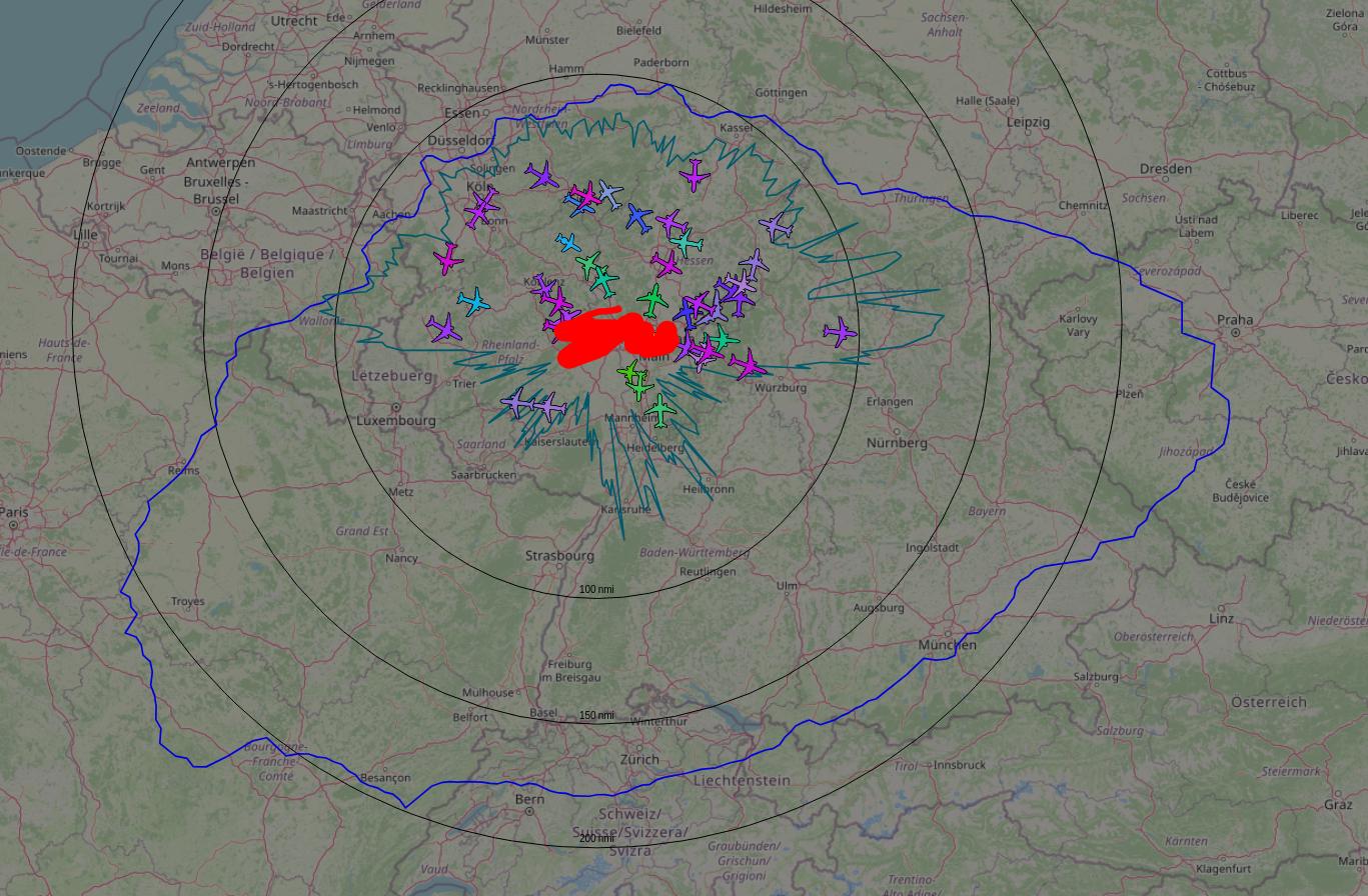
  • On the top left of the page, an URL to revisit the panorama is mentioned. It will look something like: https://www.heywhatsthat.com/?view=JM6Q9FQQ

  • Replace the XXXXX in the following command with the value after view= in your panorama URL, then run the command on your pi:

sudo /usr/local/share/tar1090/getupintheair.sh XXXXX
  • You should now have a range outline for the theoretical range for aircraft at 40000 ft on your tar1090 map

If you wish to turn the outline off or on in tar1090, use the Legend/Layers button on the top of tar1090 screen and select/unselect the "terrain-based range outline" checkbox.

http://www.heywhatsthat.com/
Your actual coverage